Wat’s Going On? – Alan Brown M.A. (Director of Archaeology).
Follow on Twitter!: https://twitter.com/caeralyn
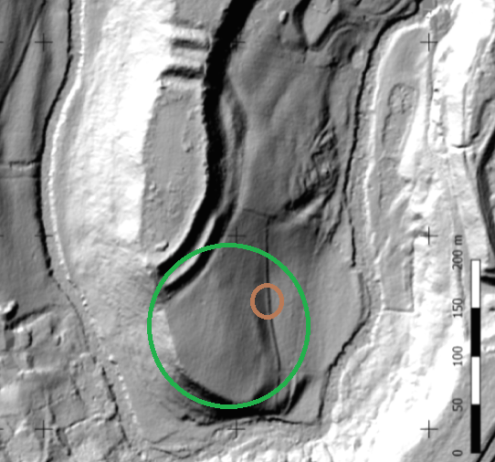
The Caer Alyn Project is situated on the edge of the village of Llay, 3.8km north of Wrexham. The core area of the project is a plateau of land surrounded on three sides by the River Alyn. This area includes an Iron Age inland promontory fort known as Caer Alyn (or Bryn Alyn Camp), which lies at the southern tip of the plateau, within a hairpin bend in the River Alyn (Fig 1).
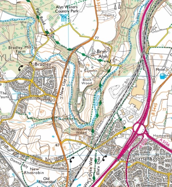 Fig 1. The location of the Caer Alyn Project. The line of the Wat’s Dyke Way is marked in green. Base map © Crown Copyright and database rights 2019 Ordnance Survey.
Sections of Wat’s Dyke have been located both to the north and south of the plateau and the most direct course between these points would be along the western edge of the…
View original post 938 more words
